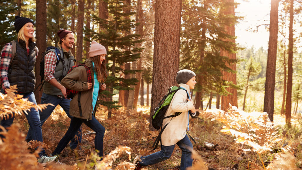
Hiking
Leksand offers excellent conditions for hiking in a variety of environments. From well-maintained, gravel paths such as Solvändan in Noret to old mountain pasture trails deep in the forest.
Before the hike
Hiking map
Hiking maps are available for purchase at the tourist office in central Leksand and at Lundells bookstore on Torget in Leksand. You can also download the Naturkartan app or visit the Naturkartan website.
Packing tips
Here is a list of items that are beneficial to pack in your bag for a longer day trip.
- Rainwear
- Water bottle
- Packed lunch
- Map
- Compass
- Blister tape
Dalkarls Road
In Leksand, Dalkarlsvägen starts at the church and follows the river along roads through the villages to Rönnäs. From Rönnäs, the trail mainly follows paths through the forest towards Bjursås. Along the way, you pass several mountain pastures.
Length: 32 km
Difficulty level: Green-blue
To experience: Villages, forests, mountain pastures
Accessibility: Signage
Starting point: Leksands Noret
Parking: Leksand Center
The Source
Several exercise trails and a lighted trail start from the orienteering club's cottage, Källan. There are marked trails ranging from three to ten kilometers in length. If you want to go further, there is a hiking trail to Asaklittstugan that is about 15 kilometers long.
Length: 3-10 km
Difficulty level: Blue
To experience: Forest, pine heath
Accessibility: Signage
Starting point: Källan orienteering hut
Parking: At Källan
The Source-Asaklitt
The hiking trail starts at Källan in Källberget, where the exercise trails also begin. The trail winds its way along paths and over gently rolling pine heathland, before finally turning into a steep climb up the mountain.
Length: 15 km
Difficulty level: Blue
To experience: Views, pine forest
Accessibility: Signage, rest area
Starting point: Källan orienteering hut
Parking: At Källan
Around Limsjön
Limsjön is a shallow, nutrient-rich bird lake adjacent to Leksand town center. A gravel walking trail circles the lake, where bird life can be observed from bird towers and a hide. The area is protected as a Natura 2000 site.
Length: 7 km
Difficulty level: Green
Things to experience: Bird life, grazing animals, wetlands, deciduous forest
Accessibility: Gravel path, bird tower, hide, outhouse, information signs
Starting point: At Norsbro
Parking: At Norsbro
See the human being
Åkersön is located opposite Leksand town center, on the other side of the river. The gravel path close to the town has been adapted in several ways and runs through flat terrain. Along the way, you can enjoy not only nature but also art.
Length: 1.5 km
Difficulty level: Green
To experience: Deciduous forest, art venues, bird life
Accessibility: Gravel path, ramp for visually impaired people, audio signs, tactile map
Starting point: On the south side of the bridge abutment or near the Folk High School
Parking: At Siljan near the Folk High School
The Sun Turn
Solvändan is a walking trail that runs along the water from Leksandsbron, around Kyrkudden, and towards Leksands Sommarland. When Sommarland is closed for the season, the walking trail runs along Siljan below the park.
Length: 8 km round trip
Difficulty level: Green
Things to experience: Beach promenade, water, birds, views
Accessibility: Gravel path, signage, and markings
Starting point: Leksand Resort or the pier, Leksand town center
Parking: Leksand Resort or the quay
Tibble-Ullvi
A tour that starts in the center of Leksand, but with many possible starting points. This tour offers great variety as it passes through villages and forests, along bird lakes, and past beautiful views.
Length: 14 km
Difficulty level: Blue
To experience: Views, bird lake, forest, and cultural environments
Accessibility: Signage, bird towers, rest areas
Starting point: Leksand town center
Parking: Kulturhusparkeringengrusade leads to Solvändan in Noret, to old mountain pasture trails deep in the forest.

5-star resort
A place full of experiences on the shores of Lake Siljan. Here you’ll find 240 cabins, 33 glamping sites, 414 campsites, and 25 Kabevagnar with access to 7 different service buildings and a laundry room. Enjoy good food in the restaurant, shop in the store, or grab an ice cream at the kiosk. Relax by the pool or on the sandy beach, play adventure golf, and let the kids play in our playgrounds. Of course, free WiFi is included throughout your stay.
- 240 cottages
- •
- 33 glamping sites
- •
- 414 campsites
- •
- 25 Cable trolleys
- •
- 7 service buildings
- •
- Laundry room
- •
- Restaurant
- •
- Shop
- •
- Kiosk
- •
- Adventure golf
- •
- Pool
- •
- Sandy beach
- •
- Playgrounds
- •
- Free WIFI